Rapid numbering and road re-naming project
Contents
Introduction
Over the recent year Council has become aware that addresses within the district are incorrect and do not comply with the New Zealand Standard Rural and Urban Addressing (NZSRUA). Of particular concern RAPID numbering is used for emergency response and there were cases where emergency services could not find the correct address in a timely manner.
There are various roads around the district which are named but, do not comply with the NZSRUA. There are also a number of roads that are formed and used by the public in the district, which are not named. Council has been notified by Land Information New Zealand (LINZ) that this is not acceptable and this needs to be rectified and comply with the NZSRUA.
In order to meet the required standards set within the NZSRUA and help mitigate safety concerns Council will be undertaking a project to renumber and rename roads within the district.
The township is included in the RAPID numbering/addressing project. Unlike RAPID numbers which are used for rural areas and utilise the measurement of the road, urban addresses are assigned sequentially according to existing and planned address sites and follow a clear logical order.
Streets in the township which have been identified as having more than 60% of properties whose addresses are out will be assigned new numbers. Nelson Street, Stewart Street and Chatfield Road have been identified as streets that require re-addressing.
What is RAPID Numbering?
RAPID numbers can be used for any rural entrance that requires an address (dwellings, sheds, yards and spreads over the property). RAPID numbering will help ensure that emergency services, visitors, utility operators and contractors can easily locate your property.
The RAPID system is a standard numbering system for rural properties based on the distance to a property entrance from a clearly defined reference point, usually the beginning of the road on which it is located.
How will my number be assigned?
In a rural area the numbers are allocated to properties by measuring the distance from the beginning of the road to the centre of the entrance to the property. Similar to this urban areas also follow distance measurements which continue through the town however, numbers will be assigned in sequence according to existing and planned address sites.
New Zealand Standard for rural and urban road addressing also requires that numbers on the right side of the road are allocated as even numbers, while those on the left side are odd. If there is more than one dwelling on a driveway, then a letter (e.g. A, B or C) is added. The first house along the driveway will be A, the second B, etc.
As RAPID and urban numbers are allocated, the information is sent to Land Information New Zealand (LINZ) national property database. Once this is added to the national property database, emergency services can then accurately locate properties in times of emergency.
How does this affect me?
Address
Properties which do not meet the rural and urban addressing standards will be correctly assigned a number. A letter will be sent to the property confirming the number change along with number plates for your new allocated number. Once the new numbers have been sent, any subsequent replacement will be at the responsibility of the landowner.
Unnamed Roads
Consultation with the public will be undertaken to name all unnamed roadways, Māori roadways and identify and name any private roadways.
Council has also contacted other providers such as energy and phone suppliers informing them of the project. However, residence will still have to contact all relative parties to confirm change of address and number.
Council has a current policy covering road naming and you can read that here: Road Naming Policy (PDF, 245KB)
What if I have a problem with my RAPID number?
It is not possible to change a number on request as it is based on the distance along the road. If you change or if you are planning to change the location of your entranceway please contact Council.
Where are the RAPID plates installed?
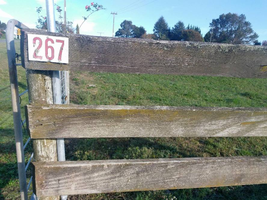
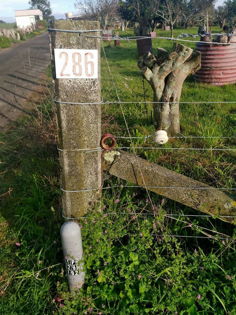
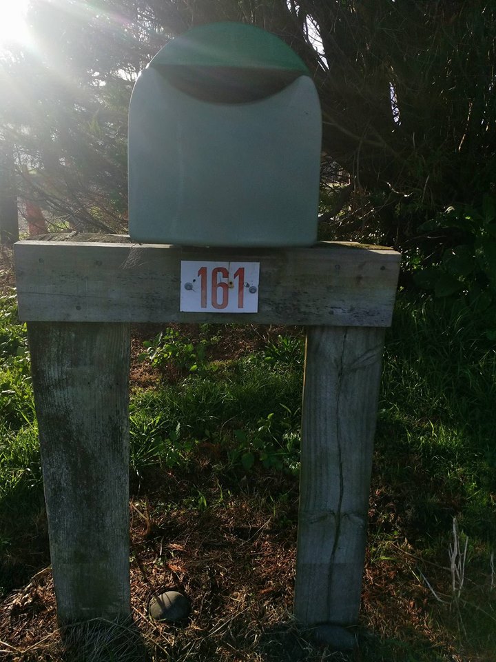
Your RAPID plate should be attached in an area which is clearly visible from the road and away from any obstacles which may obscure the plates from view (see images below).
What happens if I subdivide?
If you are subdividing new RAPID numbers will be required for any new entrances created. The existing entrance will retain the current RAPID number and this number with a suffix (e.g., A, B, C, etc.) will be allocated to any new lots using the entrance. This is because the RAPID number is based on a measured distance along a road. However, if there are five or more lots being created and they all gain access from this right of way then a new road name will be required.
What happens if I build a new house or form a new entranceway?
If you need to request an address number you can use this form: Application for address number (PDF, 106KB)
How to get your free rapid numbers
If you have received a letter of rapid number change from us you can use our simple online form to send us your acceptance of the offer to receive your free physical numbers from us.
The following are examples of correctly displayed plates:


